
Sark & Herm Weather, climate and geography
Weather & climate
These islands enjoy a temperate climate with warm summers and milder winter temperatures than those experienced in the UK. The most popular holiday season is from April to October, with temperatures averaging 20-21°C (68-70°F). These months give an average of 200 and 260 hours of sunshine. Rainfall is mainly during the cooler months. The sea is 17°C (63°F) on average during the summer.
Geography
Sark and Herm are close to mainland France. To the east of the islands lies Guernsey, to the west the Normandy coast, to the north Alderney and to the south Jersey.
Just 2.4km (1.5 miles) long and 0.8km (0.5 miles) wide, Herm is largely flat and is dominated by its sandy beaches. The tiny island of Jethou, which lies just off its south coast, was connected to Herm before a storm washed away the land that connected the two in the late eighth century.
Sark’s landmass is divided into two parts – Greater Sark and Little Sark – which are connected by a narrow belt of land called La Coupee. Until protective railings were erected here at the beginning of the 20th century, residents wishing to cross had to crawl on their hands and knees to avoid being blown over the side.
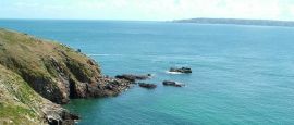
The island’s highest point is just 114m (374 ft) above sea level, and is nicknamed Le Moulin after the windmill that once stood there. Its interior is mainly gently rolling fields bordered by sandy bays and dramatic granite cliffs – the sea cave formations that pepper these cliffs are one of the most spectacular features on Sark.
The island of Brecqhou to the west, owned by the Barclay brothers since 1993, is also officially part of Sark.
Do you have any Feedback about this page?
© 2026 Columbus Travel Media Ltd. All rights reserved. No part of this site may be reproduced without our written permission, click here for information on Columbus Content Solutions.


 You know where