Canada Weather, climate and geography
Weather & climate
If you’re planning on skiing or enjoying winter sports, the best time to visit Canada is between December and April, though some resorts open as early as November and extend their seasons as late as June (or even July on Whistler’s glacier). If you want to enjoy the great outdoors without the snow, travel between May and September. Be aware, however, that if there’s been heavy snowfall during the winter, some high-altitude hiking trails may be closed well into July.
Summer thunderstorms are common throughout Canada. Occasionally, these may become severe. Tornados also occur throughout Canada, with May to September being prime months. The tornado-prone areas include most of Alberta, southwestern Quebec, and a band stretching from southern Saskatchewan through to Thunder Bay in Ontario. The interior of British Columbia and western New Brunswick are also tornado zones.
Earth tremors occur in the western mountains. Forest fires can occur at any time, regardless of the season, particularly in the grasslands and forests of western Canada.
Note: These general guidelines apply mainly to the settled areas of southern Canada. Travellers heading to northern areas, such as the Yukon, the Northwest Territories, Nunavut and Labrador, should bring warm clothing for all but the summer months (and even in summer, at least a lightweight jacket is advisable). See the individual provinces and territories sections for more details.
Winter (Dec – Feb): Winter temperatures. Winter clothing is necessary (e.g. overcoat, hat, boots and gloves). Most provinces experience heavy snowfall, with Vancouver being the main exception in that it usually rains instead.
Spring (Mar – May): Moderate temperatures. Medium weight clothing with a waterproof topcoat or umbrella is the recommendation.
Summer (Jun – Aug): Warm temperatures. Lightweight summer clothing with some medium weight clothing for cool evenings.
Autumn/ Fall (Sep – Nov): Cool, with the first frost in the air. Medium to heavyweight clothing is recommended, particularly with the first signs of snow in November.
Geography
Canada is the second-largest country by total area in the world after Russia, covering an area of 9,984,670 sq km (3,855,100 sq miles). It is bordered to the west by the North Pacific Ocean and Alaska in the northwest, to the east by the Atlantic Ocean, to the north by the Arctic Ocean, to the northeast by Greenland (across the Nares Strait), and to the south by the 'Lower 48' states of the USA. The polar ice cap lies to the north.
Canada stretches 4,634km (2,879 miles) from its northernmost point on Ellesmere Island, Nunavut to its southernmost point on Middle Island, Lake Erie, Ontario. The longest distance east to west is 5,514km (3,426 miles) from Cape Spear, Newfoundland and Labrador to the Yukon-Alaska border. Canada also has the world’s longest coastline at 202,080km (125,567 miles). The country’s highest mountain, with a peak at 5,959m (19,550ft), is Mount Logan in the Yukon Territory.
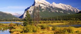
The landscape is diverse, ranging from the Arctic tundra of the north to the great prairies of the central area. Westward are the Rocky Mountains, and in the southeast are the Great Lakes, the St Lawrence River and Niagara Falls. The country is divided into 10 provinces and three territories.
Do you have any Feedback about this page?
© 2026 Columbus Travel Media Ltd. All rights reserved. No part of this site may be reproduced without our written permission, click here for information on Columbus Content Solutions.


 You know where
